Writer's Email: wesawthat@gmail.com
Fone WST... +1318.717.9017 Twitter:@wesawthat “The more corrupt the state, the more numerous the laws.” ~ Gaius Cornelius Tacitus
Female Flyer Probed For Mile-High Rub
-
Pantless passenger, 46, allegedly pleasured self en route to Miami
Katy Inzer, a Maryland bartender, told cops that she had consumed several
drinks befor...
Fluoridation Fails the US
-
US parents report that about 30% of children - approximately 8.6 million
children ages 6 to 12 - have missed school due to an oral health problem,
not ju...
Speed Cameras Painted, Burned in France, Italy, UK
-
[image: Colorful French speed camera]By Richard Diamond/Staff Reports
Vigilantes in Swansea, Wales, blinded the newly replaced speed camera on
Llangyfelach...
Abdur Biswas (Sep 1, 1926 - Nov 3, 2017)
-
Bangladeshi Statesman. He served as the 11th President of Bangladesh from
October 10, 1991 to October 9, 1996. He was educated at Dhaka University
where he...
Thank You.
-
I've never been much of a writer (let alone one of my father's caliber),
but I know that I must express my thanks to you all somehow.
The support that we h...
Beaumont, Texas lawyer Brent Coon caused a bit of a stir during Friday's status conference for the multi-district litigation (MDL) regarding the BP oil spill when he introduced around seven million documents from a previous class action against BP.
Coon, who serves on a plaintiffs discovery committee, spoke at the end of a hearing in U.S. District Judge Carl Barbier's courtroom at the Eastern District of Louisiana in New Orleans.
Wearing a brown blazer and jeans, Coon said that the plaintiff steering committee asked to go through the files from discovery he conducted while representing plaintiffs in a suit regarding an explosion at BP's Texas City refinery.
The files were contained on an external computer hard drive that Coon brought to the hearing.
"I'm not sure what just happened," Barbier said after Coon had presented the hard drive. ~ read more
louisiana governor piyush "bobby" jindal calls a press conference (began at 12:43 pm cdt) on the mariner energy inc oil rig explosion to say over and over again "we've not independently verified that."
On Thursday, I boarded a Coast Guard reconnoissance (sic) plane, an HC-144A, with around five members of the mainstream media and about a dozen or so coast-guardsmen. From Lakefront Airport in New Orleans, it took about 45 minutes to finally arrive at the site .... read more
(CNN) -- The one really big question hanging over President Obama's weekend vacation to Panama City, Florida, now has an answer.
Will he or won't he dive into the water to send a message that the Gulf Coast is back?
The answer: He will, and sooner than expected.
"I think we're going to go tomorrow and as I just said Ed, I'm not going to let you guys take a picture of me with my shirt off," Obama jokingly told CNN Saturday. "You guys will tease me just like last time. I was on the front page ... People commenting."
But just hours later, a photo was published on the White House Flickr page showing a smiling President Obama and his daughter Sasha taking a dip in the Gulf waters off Alligator Point in Panama City Beach, Florida.
No reporters or press cameras were present for the swim, but the image will nonetheless send a message that the White House has sought to convey with the first family's trip: the Gulf Coast is open for business. ~ read more emphasis added
russian news-babe, natalie sedletska, reports that the russian wildfires are causing big trouble for russian citizenry and the government.
many fear that the fire at chernobyl will stir up radioactive particles in the ground and send them into the atmosphere.
apparently, pootie poot and his side-kick dmitry medvedev, have ordered the russian media and medical establishment to under-report or misreport the threat to russia's nuclear facilities and the high mortality rate because of the fires.
so far, the russian government will only own up to 53 deaths directly attributable to the fires.
the wildfires also threaten another russian nuclear installation near the "secret nuclear town of sarov."
the russian government is facing a severe credibility crisis because of its perceived "mishandling of the situation."
sounds like this russian wildfire is their version of our deepwater horizon oil catastrophe. the release of nuclear particles from the burning of forests laden by radioactive fallout of the chernobyl disaster and the possibility of other nuclear sites burning seems to correlate to all the reports and speculations about the release of benzene, methane and other poisonous volatile organic compounds from the deepwater horizon oil catastrophe.
BULLETIN TROPICAL DEPRESSION FIVE ADVISORY NUMBER 5 NWS TPC/NATIONAL HURRICANE CENTER MIAMI FL AL052010 400 PM CDT WED AUG 11 2010
...DEPRESSION DISSIPATES...THIS IS THE LAST ADVISORY.....
POTENTIAL FOR HEAVY RAINFALL ALONG THE GULF COAST REMAINS...
RAINFALL...TOTAL RAIN ACCUMULATIONS OF 3 TO 5 INCHES WITH ISOLATED MAXIMUM AMOUNTS OF 8 INCHES ARE POSSIBLE FROM SOUTHEASTERN LOUISIANA TO THE WESTERN FLORIDA PANHANDLE THROUGH FRIDAY MORNING.
STORM SURGE...A STORM SURGE COULD RAISE WATER LEVELS BY AS MUCH AS 1 TO 2 FEET ABOVE GROUND LEVEL ALONG THE IMMEDIATE COAST IN AREAS OF ONSHORE WIND.
NEXT ADVISORY ------------- THIS IS THE LAST PUBLIC ADVISORY ISSUED BY THE NATIONAL HURRICANE CENTER ON THIS SYSTEM. ADDITIONAL INFORMATION ON THE POTENTIAL RAINFALL THREAT CAN BE FOUND IN FORECASTS ISSUED BY THE HYDROMETEOROLOGICAL PREDICTION CENTER AND LOCAL NATIONAL WEATHER SERVICE FORECAST OFFICES.
BULLETIN TROPICAL DEPRESSION FIVE SPECIAL ADVISORY NUMBER 1 NWS TPC/NATIONAL HURRICANE CENTER MIAMI FL AL052010 730 PM EDT TUE AUG 10 2010
...TROPICAL DEPRESSION FORMS OVER THE SOUTHEASTERN GULF OF MEXICO...
SUMMARY OF 730 PM EDT...2330 UTC...INFORMATION ---------------------------------------------- LOCATION...26.0N 84.1W ABOUT 260 MI...420 KM SSE OF APALACHICOLA FLORIDA ABOUT 375 MI...600 KM SE OF THE MOUTH OF THE MISSISSIPPI RIVER MAXIMUM SUSTAINED WINDS...35 MPH...55 KM/HR PRESENT MOVEMENT...NW OR 315 DEGREES AT 6 MPH...9 KM/HR MINIMUM CENTRAL PRESSURE...1007 MB...29.74 INCHES
WATCHES AND WARNINGS -------------------- CHANGES WITH THIS ADVISORY...
A TROPICAL STORM WARNING HAS BEEN ISSUED FOR THE NORTHERN GULF OF MEXICO COAST FROM DESTIN FLORIDA TO INTRACOASTAL CITY LOUISIANA...INCLUDING LAKE PONTCHARTRAIN AND NEW ORLEANS.
SUMMARY OF WATCHES AND WARNINGS IN EFFECT...
A TROPICAL STORM WARNING IS IN EFFECT FOR...* DESTIN FLORIDA TO INTRACOASTAL CITY LOUISIANA...INCLUDING LAKE PONTCHARTRAIN AND NEW ORLEANS
A TROPICAL STORM WARNING MEANS THAT TROPICAL STORM CONDITIONS ARE EXPECTED SOMEWHERE WITHIN THE WARNING AREA WITHIN 36 HOURS.
FOR STORM INFORMATION SPECIFIC TO YOUR AREA IN THE UNITED STATES...INCLUDING POSSIBLE INLAND WATCHES AND WARNINGS...PLEASE MONITOR PRODUCTS ISSUED BY YOUR LOCAL NATIONAL WEATHER SERVICE FORECAST OFFICE.
DISCUSSION AND 48-HOUR OUTLOOK ------------------------------ AT 730 PM EDT...2330 UTC...THE CENTER OF TROPICAL DEPRESSION FIVE WAS LOCATED NEAR LATITUDE 26.0 NORTH...LONGITUDE 84.1 WEST. THE DEPRESSION IS MOVING TOWARD THE NORTHWEST NEAR 6 MPH...9 KM/HR A GRADUAL TURN TOWARD THE WEST-NORTHWEST WITH AN INCREASE IN FORWARD SPEED IS EXPECTED ON WEDNESDAY. ON THE FORECAST TRACK...THE CENTER OF THE TROPICAL CYCLONE WILL BE APPROACHING THE NORTH CENTRAL GULF OF MEXICO BY LATE WEDNESDAY OR EARLY THURSDAY.
MAXIMUM SUSTAINED WINDS ARE NEAR 35 MPH...55 KM/HR...WITH HIGHER GUSTS. SLOW STRENGTHENING IS EXPECTED...AND THE DEPRESSION IS FORECAST TO BECOME A TROPICAL STORM ON WEDNESDAY.
ESTIMATED MINIMUM CENTRAL PRESSURE IS 1007 MB...29.74 INCHES.
HAZARDS AFFECTING LAND ---------------------- RAINFALL...TOTAL RAIN ACCUMULATIONS OF 3 TO 5 INCHES WITH ISOLATED MAXIMUM AMOUNTS OF 8 TO 10 INCHES ARE POSSIBLE ALONG THE NORTHERN AND NORTHEASTERN GULF OF MEXICO COAST.
WIND...TROPICAL STORM CONDITIONS ARE EXPECTED TO BEGIN AFFECTING THE TROPICAL STORM WARNING AREA BY LATE WEDNESDAY...MAKING OUTSIDE PREPARATIONS DIFFICULT OR DANGEROUS.
STORM SURGE...A STORM SURGE WILL RAISE WATER LEVELS BY AS MUCH AS 2 TO 4 FEET ABOVE GROUND LEVEL ALONG THE IMMEDIATE COAST NEAR AND TO THE EAST OF WHERE THE CENTER MAKES LANDFALL.
NEXT ADVISORY ------------- NEXT ADVISORY...1100 PM EDT.
joined in studio by guest seumas milne, associate editor, guardian uk newspaper to discuss his recent column in which he said that the afghan war exposed the weakness of america's global power.
on the phone is colin butfield, head of campaigns at the world wildlife fund to talk about the lasting damage to wildlife from the deepwater horizon oil catastrophe.
mr. butfield points out that "oil is, of course, a naturally occurring substance, it will breakdown over time -- the key question is what happens to it between now and the point that it does breakdown and it will be different in the deep-water environment and to it washing up on shore."
"i think that you have to fall into two categories: one is the immediate on the ground stuff that they can do in terms of both the clearing up and stopping of the oil that's immediately there. as well as paying for regeneration on the ground of areas of wetlands and things like that.
but you're right in saying that some of [the environment] just wont recover, obviously a dolphin cant sue. so one of the things that we're particularly concerned about is the impact on bp and on the other oil companies future operations. obviously this is only one of their deep-sea offshore drilling operations and there's numerous others and numerous plans to have several more including up in the arctic which is a far more difficult environment to contain an oil spill -- far less infrastructure than there is in the gulf of mexico -- a far more difficult sea -- far worse environmental conditions in terms of the impact.
and we'd like to see far greater restrictions placed upon the drilling that companies like bp can do both in terms of the immediate on the ground impact but also in terms of moving away from our oil dependency and using this as a catalyst to start to direct things towards lower carbon, less risky both in terms of environmental and financial impact sources of generating energy." colin butfield, wwf. emphasis added.
The National Hurricane Center said Bonnie came ashore Friday midday near Cutler Bay, about 20 miles south of Miami, with top sustained winds of 40 mph. It blew across Collier County around 2 p.m. with intermittent showers and occasional gusty winds. There are no reports of significant damage so far with many locals in the area going about their daily routines.
“I’m not too concerned about the storm,” said Rick Knuth, a Naples resident sitting at a busy Starbucks with his laptop. “I saw that it wasn’t too bad, grabbed my stuff and headed out to get some coffee.”
Collier County’s Bureau of Emergency Services saw the weakness of the storm and decided against pulling together its emergency operations team, such as Red Cross.
Instead, emergency responders continued to monitor the storm.
“This warranted watching but ... it wasn’t anything significant, particularly it being an exiting event,” said Director Dan Summers. “Having the opportunity to lessen in intensity a little bit over the land mass, in this particular case, really worked out to our advantage.”
Between 7 a.m. and 4 p.m., Bonnie sprinkled between a quarter of an inch and a half inch of rain in Collier County, according to South Florida Water Management District. ~ read more
UPDATED 000 WTNT33 KNHC 242034 TCPAT3 BULLETIN TROPICAL DEPRESSION BONNIE ADVISORY NUMBER 10 NWS TPC/NATIONAL HURRICANE CENTER MIAMI FL AL032010 400 PM CDT SAT JUL 24 2010
...BONNIE DEGENERATES INTO A DISORGANIZED AREA OF LOW PRESSURE...
SUMMARY OF 400 PM CDT...2100 UTC...INFORMATION ---------------------------------------------- LOCATION...28.5N 87.6W ABOUT 100 MI...160 KM ESE OF THE MOUTH OF THE MISSISSIPPI RIVER MAXIMUM SUSTAINED WINDS...30 MPH...45 KM/HR PRESENT MOVEMENT...WNW OR 300 DEGREES AT 14 MPH...22 KM/HR MINIMUM CENTRAL PRESSURE...1011 MB...29.85 INCHES
WATCHES AND WARNINGS -------------------- THERE ARE NO COASTAL WATCHES OR WARNINGS IN EFFECT.
DISCUSSION AND 48-HOUR OUTLOOK ------------------------------ AT 400 PM CDT...2100 UTC...THE CENTER OF THE REMNANT LOW ASSOCIATED WITH FORMER TROPICAL DEPRESSION BONNIE WAS LOCATED NEAR LATITUDE 28.5 NORTH...LONGITUDE 87.6 WEST. THE LOW IS MOVING TOWARD THE WEST-NORTHWEST NEAR 14 MPH...22 KM/HR AND IT SHOULD CONTINUE TO MOVE ON THIS GENERAL TRACK TONIGHT AND SUNDAY.
MAXIMUM SUSTAINED WINDS ARE BARELY 30 MPH...45 KM/HR...WITH HIGHER GUSTS IN A FEW SQUALLS. THE LOW IS EXPECTED TO DISSIPATE TONIGHT OR SUNDAY.
MINIMUM CENTRAL PRESSURE REPORTED BY AN AIR FORCE PLANE WAS 1011 MB...29.85 INCHES.
HAZARDS AFFECTING LAND ---------------------- WIND...A FEW SQUALLS ARE LIKELY TO SPREAD OVER PORTIONS OF THE NORTHERN GULF COAST...FROM SOUTHEAST LOUISIANA EASTWARD TO THE FAR WESTERN FLORIDA PANHANDLE LATER TODAY.
RAINFALL...BONNIE IS EXPECTED TO PRODUCE TOTAL RAINFALL ACCUMULATIONS OF 1 TO 2 INCHES OVER PORTIONS OF SOUTHERN LOUISIANA...SOUTHERN ALABAMA...SOUTHERN MISSISSIPPI...AND THE FAR WESTERN FLORIDA PANHANDLE...WITH POSSIBLE ISOLATED MAXIMUM AMOUNTS OF 3 INCHES.
NEXT ADVISORY ------------- THIS IS THE LAST PUBLIC ADVISORY ISSUED BY THE NATIONAL HURRICANE CENTER ON THIS SYSTEM. ADDITIONAL INFORMATION ON THIS SYSTEM CAN BE FOUND IN HIGH SEAS FORECASTS ISSUED BY THE NATIONAL WEATHER SERVICE...UNDER AWIPS HEADER NFDHSFAT1 AND WMO HEADER FZNT01 KWBC.
DATA FROM AN AIR FORCE HURRICANE HUNTER RECONNAISSANCE AIRCRAFT DURING THE PAST HOUR INDICATE THAT SURFACE WINDS ASSOCIATED WITH THE DEPRESSION HAVE INCREASED TO 40 MPH...65 KM/HR...AND THAT THE DEPRESSION HAS BECOME A TROPICAL STORM.
SUMMARY OF 615 PM EDT...2215 UTC...INFORMATION -------------------------------------------------- LOCATION...22.9N 75.4W ABOUT 200 MI...320 KM SE OF NASSAU ABOUT 415 MI...670 KM ESE OF KEY WEST FLORIDA MAXIMUM SUSTAINED WINDS...40 MPH...65 KM/HR PRESENT MOVEMENT...NW OR 315 DEGREES AT 14 MPH...22 KM/HR MINIMUM CENTRAL PRESSURE...1005 MB...29.68 INCHES
$$ FORECASTER KIMBERLAIN/BEVEN
====
====
====
TROPICAL DEPRESSION THREE ADVISORY NUMBER 1 NWS TPC/NATIONAL HURRICANE CENTER MIAMI FL AL032010 1100 AM EDT THU JUL 22 2010
...TROPICAL DEPRESSION FORMS IN THE BAHAMAS...AIR FORCE RECONNAISSANCE PLANE EN ROUTE...
SUMMARY OF 1100 AM EDT...1500 UTC...INFORMATION ----------------------------------------------- LOCATION...21.9N 75.0W ABOUT 265 MI...425 KM SE OF NASSAU ABOUT 405 MI...655 KM ESE OF KEY LARGO FLORIDA MAXIMUM SUSTAINED WINDS...35 MPH...55 KM/HR PRESENT MOVEMENT...WNW OR 295 DEGREES AT 15 MPH...24 KM/HR MINIMUM CENTRAL PRESSURE...1008 MB...29.77 INCHES
WATCHES AND WARNINGS -------------------- CHANGES WITH THIS ADVISORY...
THE GOVERNMENT OF THE BAHAMAS HAS ISSUED A TROPICAL STORM WARNING FOR THE CENTRAL AND NORTHWESTERN BAHAMAS.
A TROPICAL STORM WARNING HAS BEEN ISSUED FOR THE FLORIDA EAST COAST FROM GOLDEN BEACH SOUTHWARD INCLUDING THE ENTIRE FLORIDA KEYS AND FLORIDA BAY...AND ALONG THE WEST COAST OF FLORIDA NORTHWARD TO BONITA BEACH.
A TROPICAL STORM WATCH HAS BEEN ISSUED FOR THE EAST COAST OF FLORIDA FROM NORTH OF GOLDEN BEACH TO JUPITER INLET INCLUDING LAKE OKEECHOBEE.
SUMMARY OF WATCHES AND WARNINGS IN EFFECT...
A TROPICAL STORM WARNING IS IN EFFECT FOR... * CENTRAL AND NORTHWESTERN BAHAMAS * FOR THE FLORIDA EAST COAST FROM GOLDEN BEACH SOUTHWARD INCLUDING THE ENTIRE FLORIDA KEYS AND FLORIDA BAY...AND ALONG THE WEST COAST OF FLORIDA NORTHWARD TO BONITA BEACH
A TROPICAL STORM WATCH IN IN EFFECT FOR... * THE EAST COAST OF FLORIDA NORTH OF GOLDEN BEACH TO JUPITER INLET INCLUDING LAKE OKEECHOBEE
A TROPICAL STORM WARNING MEANS THAT TROPICAL STORM CONDITIONS ARE EXPECTED SOMEWHERE WITHIN THE WARNING AREA WITHIN 36 HOURS.
A TROPICAL STORM WATCH MEANS THAT TROPICAL STORM CONDITIONS ARE POSSIBLE WITHIN THE WATCH AREA...GENERALLY WITHIN 48 HOURS.
FOR STORM INFORMATION SPECIFIC TO YOUR AREA IN THE UNITED STATES...INCLUDING POSSIBLE INLAND WATCHES AND WARNINGS...PLEASE MONITOR PRODUCTS ISSUED BY YOUR LOCAL NATIONAL WEATHER SERVICE FORECAST OFFICE. FOR STORM INFORMATION SPECIFIC TO YOUR AREA OUTSIDE UNITED STATES...PLEASE MONITOR PRODUCTS ISSUED BY YOUR NATIONAL METEOROLOGICAL SERVICE.
DISCUSSION AND 48-HOUR OUTLOOK ------------------------------ AT 1100 AM EDT...1500 UTC...THE CENTER OF NEWLY FORMED TROPICAL DEPRESSION THREE WAS LOCATED NEAR LATITUDE 21.9 NORTH...LONGITUDE 75.0 WEST. THE DEPRESSION IS MOVING TOWARD THE WEST-NORTHWEST NEAR 15 MPH...24 KM/HR. THIS GENERAL MOTION WITH AN INCREASE IN FORWARD SPEED IS EXPECTED DURING THE NEXT 48 HOURS.
MAXIMUM SUSTAINED WINDS ARE NEAR 35 MPH...55 KM/HR...WITH HIGHER GUSTS. THE DEPRESSION COULD BECOME A TROPICAL STORM LATER TODAY.
ESTIMATED MINIMUM CENTRAL PRESSURE IS 1008 MB...29.77 INCHES.
HAZARDS AFFECTING LAND ---------------------- WIND...WINDS NEAR TROPICAL STORM FORCE ARE ALREADY AFFECTING PORTIONS OF THE SOUTHEASTERN BAHAMAS. TROPICAL STORM CONDITIONS WILL GRADUALLY SPREAD OVER THE CENTRAL AND NORTHWESTERN BAHAMAS TONIGHT AND FRIDAY. WEATHER CONDITIONS WILL BEGIN TO DETERIORATE ON THE FLORIDA COAST AND FLORIDA KEYS WITHIN THE WARNING AREA ON FRIDAY.
RAINFALL...THE DEPRESSION IS EXPECTED TO PRODUCE TOTAL RAIN ACCUMULATIONS OF OF 2 TO 4 INCHES OVER SOUTH FLORIDA...WITH POSSIBLE ISOLATED MAXIMUM AMOUNTS OF 5 TO 6 INCHES. RAINFALL AMOUNTS OF 3 TO 5 INCHES ARE EXPECTED OVER THE CENTRAL AND NORTHWEST BAHAMAS...WITH POSSIBLE ISOLATED AMOUNTS OF 5 TO 7 INCHES.
STORM SURGE...STORM SURGE WILL RAISE WATER LEVELS BY AS MUCH AS 1 TO 2 FEET ABOVE GROUND LEVEL OVER PORTIONS OF THE BAHAMAS AND THE FLORIDA KEYS.
NEXT ADVISORY ------------- NEXT INTERMEDIATE ADVISORY...200 PM EDT. NEXT COMPLETE ADVISORY...500 PM EDT.
for they that are such serve not our lord jesus christ, but their own belly; and by good words and fair speeches deceive the hearts of the simple. ~ romans 16:18 kjv
we attempted to record the entire rally live from off the rally for economic survival website and everything was going well until our computer locked up and then crashed in the middle of the speech by plaquemines parish, president billy nungesser.
maybe someone out in the audience got some hi-res snaps or video of lt. gov. scott angelle repeatedly giving the mano cornuto as he was introducing pi.
when we logged on about 10 - 15 minutes before the rally began there were already 700+ viewers and shortly before our crash the view counter had shot up to over 3,000 so there were a lot of interested people out here
we're not for any moratorium or putting people out of work or anything like that.
BP says new cap on well fully closed, no oil going into Gulf
ASSOCIATED PRESS • July 15, 2010
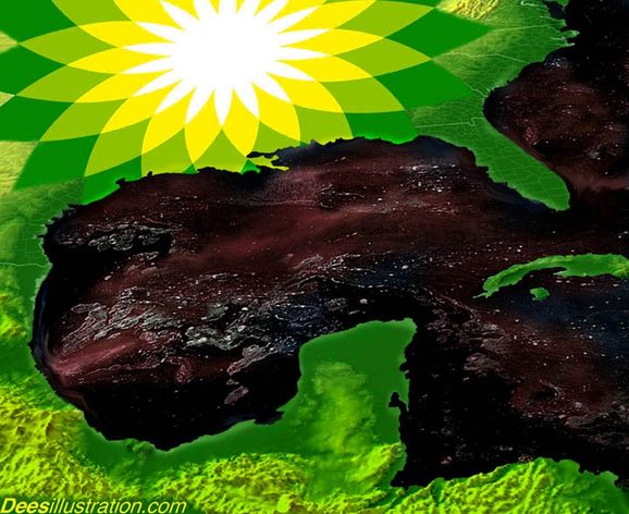
NEW ORLEANS —BP says oil from its broken well has stopped gushing into the Gulf of Mexico for the first time since April.
The announcement Thursday came after company officials said all valves had been shut on a new cap over the busted well in an experiment to stop the spill.
Kent Wells, a BP PLC vice president, said at a news briefing that oil stopped flowing into the water at 2:25 p.m. CDT. [1925 GMT/UTC]
It was a long-awaited milestone in one of the nation’s worst environmental disasters. While not a permanent solution to plug the busted well, the success in capturing the oil spewing out was welcome news.
The crisis began when BP’s deepwater rig exploded, killing 11 workers.
The cap is not a permanent fix. BP is drilling two relief wells so it can pump mud and cement into the leaking well in hopes of plugging it for good. ~ view original
====
this is a clip from a bp camera recorded from 2150 - 2229 CDT 12 july 2010 (0250 - 0329 GMT/UTC 13 july 2010}
Setback Delays ‘Top Kill’ Effort to Seal Leaking Oil Well in Gulf
By CLIFFORD KRAUSS, JOHN M. BRODER and LIZ ROBBINS Published: May 27, 2010
HOUSTON — BP had to halt its ambitious effort to plug its stricken oil well in the Gulf of Mexico on Thursday afternoon when engineers saw that too much of the drilling fluid they were injecting into the well was escaping along with the leaking crude oil.
A technician at the BP command center said that pumping of the fluid had to be stopped temporarily while engineers were revising their plans, and that the company hoped to resume pumping by midnight, if federal officials approved. ~ read more
link ==== house.gov spill cam link ==== see also deepwater horizon oil catastrophe 2010 label in the footer of this post ==== originally posted 24 may 2010 905 pm cdt ====
The Ocean Energy Institute, founded in 2007 by Matthew R. Simmons, is a think-tank and venture capital fund addressing the challenges of U.S. offshore renewable energy.
OEI approaches energy R&D and investment from a systems point of view; not just generation, but usage, storage and transmission all together as an interdependent set of opportunities and the next driving force of the international economy.
dean blanchard of dean blanchard seafood, inc. talks about some of the things he's seen happening to grand isle since the deepwater horizon oil catastrophe and the ensuing governmental response.
"the military got here about thirty days ago. all my life i couldnt figure out why all these foreign countries hated us so much; but if thats the way the military treats them when we send them out there, i can see why now...."
000 WTNT32 KNHC 080304 TCPAT2 BULLETIN TROPICAL DEPRESSION TWO ADVISORY NUMBER 1 NWS TPC/NATIONAL HURRICANE CENTER MIAMI FL AL022010 1000 PM CDT WED JUL 07 2010
...SECOND TROPICAL DEPRESSION OF THE ATLANTIC SEASON FORMS OVER THE WESTERN GULF OF MEXICO...TROPICAL STORM WARNINGS ISSUED...
SUMMARY OF 1000 PM CDT...0300 UTC...INFORMATION ----------------------------------------------- LOCATION...23.9N 93.9W ABOUT 265 MI...425 KM ESE OF BROWNSVILLE TEXAS ABOUT 245 MI...395 KM E OF LA PESCA MEXICO MAXIMUM SUSTAINED WINDS...35 MPH...55 KM/HR PRESENT MOVEMENT...NW OR 310 DEGREES AT 14 MPH...22 KM/HR MINIMUM CENTRAL PRESSURE...1005 MB...29.68 INCHES
WATCHES AND WARNINGS -------------------- CHANGES WITH THIS ADVISORY...
A TROPICAL STORM WARNING HAS BEEN ISSUED ALONG THE TEXAS COAST SOUTH OF BAFFIN BAY TO THE MOUTH OF THE RIO GRANDE...AND THE GOVERNMENT OF MEXICO HAS ISSUED A TROPICAL STORM WARNING ALONG THE COAST OF MEXICO FROM RIO SAN FERNANDO TO THE MOUTH OF THE RIO GRANDE.
SUMMARY OF WATCHES AND WARNINGS IN EFFECT...
A TROPICAL STORM WARNING IS IN EFFECT FOR...* FROM SOUTH OF BAFFIN BAY TEXAS TO RIO SAN FERNANDO MEXICO
A TROPICAL STORM WARNING MEANS THAT TROPICAL STORM CONDITIONS ARE EXPECTED SOMEWHERE WITHIN THE WARNING AREA...IN THIS CASE WITHIN 24 HOURS.
FOR STORM INFORMATION SPECIFIC TO YOUR AREA IN THE UNITED STATES...INCLUDING POSSIBLE INLAND WATCHES AND WARNINGS...PLEASE MONITOR PRODUCTS ISSUED BY YOUR LOCAL NATIONAL WEATHER SERVICE FORECAST OFFICE. FOR STORM INFORMATION SPECIFIC TO YOUR AREA OUTSIDE UNITED STATES...PLEASE MONITOR PRODUCTS ISSUED BY YOUR NATIONAL METEOROLOGICAL SERVICE.
DISCUSSION AND 48-HOUR OUTLOOK ------------------------------ AT 1000 PM CDT...0300 UTC...THE CENTER OF TROPICAL DEPRESSION TWO WAS LOCATED NEAR LATITUDE 23.9 NORTH...LONGITUDE 93.9 WEST. THE DEPRESSION IS MOVING TOWARD THE NORTHWEST NEAR 14 MPH...22 KM/HR...AND THIS GENERAL MOTION ACCOMPANIED BY A SLIGHT DECREASE IN FORWARD SPEED IS EXPECTED FOR THE NEXT 24 HOURS OR SO. ON THE FORECAST TRACK...THE DEPRESSION IS EXPECTED TO MAKE LANDFALL NEAR THE TEXAS-MEXICO BORDER THURSDAY AFTERNOON OR EARLY EVENING.
MAXIMUM SUSTAINED WINDS ARE NEAR 35 MPH...55 KM/HR...WITH HIGHER GUSTS. SOME GRADUAL STRENGTHENING IS FORECAST AND THE DEPRESSION COULD BECOME A TROPICAL STORM BEFORE LANDFALL OCCURS ON THURSDAY.
THE MINIMUM CENTRAL PRESSURE BASED ON NOAA AIRCRAFT RECONNAISSANCE DATA IS ESTIMATED TO BE 1005 MB...29.68 INCHES.
HAZARDS AFFECTING LAND ---------------------- RAINFALL...THE DEPRESSION IS EXPECTED TO PRODUCE TOTAL RAIN ACCUMULATIONS OF 4 TO 8 INCHES OVER PORTIONS OF FAR NORTHEASTERN MEXICO AND COASTAL TEXAS...WITH ISOLATED MAXIMUM AMOUNTS OF 10 INCHES.
WIND...TROPICAL-STORM-FORCE WINDS ARE EXPECTED TO REACH THE COAST WITHIN THE WARNING AREA BY THURSDAY AFTERNOON.
NEXT ADVISORY ------------- NEXT INTERMEDIATE ADVISORY...100 AM CDT. NEXT COMPLETE ADVISORY...400 AM CDT.
TIMBALIER ISLANDS, La. – Not just flora and fauna are getting caked in oil. So is the Gulf of Mexico's barnacled history of pirates, sea battles and World War II shipwrecks.
The Gulf is lined with wooden shipwrecks, American-Indian shell midden mounds, World War II casualties, pirate colonies, historic hotels and old fishing villages.
Researchers now fear this treasure seeker's dream is threatened by BP PLC's deepwater well blowout. ~ read more
000 WTNT31 KNHC 020232 TCPAT1 BULLETIN TROPICAL DEPRESSION ALEX ADVISORY NUMBER 26 NWS TPC/NATIONAL HURRICANE CENTER MIAMI FL AL012010 1000 PM CDT THU JUL 01 2010
...ALEX DISSIPATES OVER THE MOUNTAINS OF CENTRAL MEXICO...
SUMMARY OF 1000 PM CDT...0300 UTC...INFORMATION ----------------------------------------------- LOCATION...23.3N 102.4W ABOUT 35 MI...55 KM...NNE OF ZACATECAS MEXICO MAXIMUM SUSTAINED WINDS...30 MPH...45 KM/HR PRESENT MOVEMENT...W OR 275 DEGREES AT 12 MPH...19 KM/HR MINIMUM CENTRAL PRESSURE...1000 MB...29.53 INCHES
WATCHES AND WARNINGS -------------------- THERE ARE NO COASTAL WATCHES OR WARNINGS IN EFFECT.
DISCUSSION AND 48-HOUR OUTLOOK ------------------------------ AT 1000 PM CDT...0300 UTC...THE REMNANTS OF ALEX WERE CENTERED NEAR LATITUDE 23.3 NORTH...LONGITUDE 102.4 WEST. THE REMNANTS ARE MOVING TOWARD THE WEST NEAR 12 MPH...19 KM/HR...AND THIS GENERAL MOTION WILL CONTINUE OVERNIGHT.
MAXIMUM SUSTAINED WINDS ARE NEAR 30 MPH...45 KM/HR...WITH HIGHER GUSTS. WINDS ASSOCIATED WITH THE REMNANTS OF ALEX WILL CONTINUE TO DECREASE OVERNIGHT.
ESTIMATED MINIMUM CENTRAL PRESSURE IS 1000 MB...29.53 INCHES.
HAZARDS AFFECTING LAND ---------------------- RAINFALL...THE REMNANTS OF ALEX ARE EXPECTED TO PRODUCE ADDITIONAL RAINFALL ACCUMULATIONS OF 3 TO 6 INCHES ACROSS PORTIONS OF NORTHERN AND CENTRAL MEXICO. ISOLATED STORM-TOTAL AMOUNTS OF 20 INCHES ARE POSSIBLE OVER THE HIGHER ELEVATIONS OF NORTHEASTERN MEXICO.
THESE RAINS COULD CAUSE LIFE-THREATENING FLASH FLOODS AND MUD SLIDES...ESPECIALLY IN MOUNTAINOUS TERRAIN.
THE REMNANTS OF ALEX ARE ALSO EXPECTED TO PRODUCE ADDITIONAL RAINFALL ACCUMULATIONS OF 2 TO 4 INCHES OVER PORTIONS OF SOUTHERN TEXAS...WITH ISOLATED MAXIMUM STORM-TOTAL AMOUNTS OF AROUND 12 INCHES. THESE RAINS COULD CAUSE LIFE-THREATENING FLASH FLOODS.
NEXT ADVISORY ------------- THIS IS THE LAST PUBLIC ADVISORY ISSUED BY THE NATIONAL HURRICANE CENTER ON THIS SYSTEM. PLEASE REFER TO PRODUCTS ISSUED BY THE HYDROMETEOROLOGICAL PREDICTION CENTER AND LOCAL NATIONAL WEATHER SERVICE FORECAST OFFICES FOR ADDITIONAL INFORMATION ON THE POTENTIAL FOR HEAVY RAINFALL AND FLOODING.
america has just announced after more than 70 days that its ready to accept assistance from 12 foreign countries.
danny schechter, with mediachannel.org says that after all the experiments they tried to cap the well ... failing, "their faith in the relief wells is now being tested."
however,
"red tape, including bp's stance, is preventing other companies who volunteered oil collection boats are being rebuffed, by bp and the coast guard according to a french company as reported in new orleans.
even as local officials complain that not enough boats or vessels have been deployed to collect the oil in water before it hits land. this is a big issue about whether to reach out to people in other countries."
====
UPDATE:
000 WTNT31 KNHC 300231 TCPAT1 BULLETIN HURRICANE ALEX ADVISORY NUMBER 18 NWS TPC/NATIONAL HURRICANE CENTER MIAMI FL AL012010 1000 PM CDT TUE JUN 29 2010
...ALEX BECOMES THE FIRST HURRICANE OF THE 2010 SEASON AND THE FIRST JUNE ATLANTIC HURRICANE SINCE 1995...
SUMMARY OF 1000 PM CDT...0300 UTC...INFORMATION ----------------------------------------------- LOCATION...23.1N 94.8W ABOUT 195 MI...315 KM ESE OF LA PESCA MEXICO ABOUT 255 MI...415 KM SE OF BROWNSVILLE TEXAS MAXIMUM SUSTAINED WINDS...75 MPH...120 KM/HR PRESENT MOVEMENT...W OR 280 DEGREES AT 9 MPH...15 KM/HR MINIMUM CENTRAL PRESSURE...973 MB...28.73 INCHES ~ hurricanes.gov
The fake populist.
-
The following article was written by my friend, *Chauncey DeVega*, for *Salon
Magazine. *
"Donald Trump is not a real populist. That fact will not cha...
Announcement: Next Lobbying Deadline
-
*Lobbying Filing Deadline*
The deadline for lobbyists to file the Expenditure Report covering May 1,
2026 - May 31, 2026 is June 25, 2026.
Police Jury meets Tuesday
-
The Lincoln Parish Police Jury will meet Tuesday, June 13, Lincoln Parish
Court House, 100 West Texas, third floor. Here are the meeting times and
agendas....
Electoral Deter-men-hers
-
Virgotex summarized the matrix of root voting impulses for Dems in 2020:
Democratic voters don't want "another" white male. They want a female
candidate...
Welcome to the Alexandria Postcard Collection
-
Postcards are an important medium in telling stories of the past. They are
historical masterpieces, showing life at points in time.
Greetings from Alexandr...
Rain Update, 1:10 p.m.
-
Our OEP Director has been asked about the effect the rain from folks who
were concerned about it over topping. The pic below was taken today and
show 6-7″ ...
brief dashcam clip of alleged sex offender arrest
-
brief dashcam clip of alleged sex offender arrest
some guy on a bicycle was allegedly looking at children through binoculars
across the street from the k...
Saying goodbye to our Old House
-
I never thought this day would come. We had to say goodbye to the “Big
House”, the old house, the Hynson-Ringgold house (and many other names)….
We were tr...
57th presidential inauguration 21 january 2013
-
57th presidential inauguration 21 january 2013
oath of office and speech + more.
From: wesawthat1
Views: 748
10 ratings
Time: 57:56 More in News & Politics
Part 6: The Marriage Feast
-
The souls and spirits of those who placed their faith in the Messiah are
reunited with resurrected bodies at the return of Christ, followed by the
transfor...
Responding to Ben Dunson’s Critique of Kinism
-
By Davis Carlton Dr. Ben Dunson, Professor of New Testament at Greenville
Presbyterian Theological Seminary, has posted an article critiquing Kinism.
Dunso...
The Real Origins of Neocons
-
*Russian Lies: Shadow of Jabotinksy*
by Joachim Martillo (ThorsProvoni@aol.com)
Philip Weiss reviews *They Knew They Were Right: The Rise of the Neocons, ...
Our Future Looks Glorious…if We Repent
-
“The Lord will not let the righteous go hungry…” ~ Proverbs 10:3 I remember
how this text struck me as I read it for the first time as a young boy[...]
Last Days Lunacy and End Times Madness
-
Podcast: LAST DAYS LUNACY and END TIMES MADNESS (The following commentary
is a reprint of the chapter Bible Basics 101: Last Days/End Times and The
Second ...